Monday topple water level of the lake
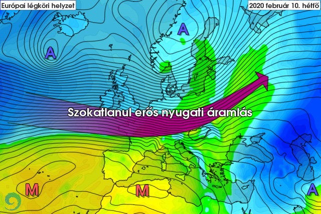
By the beginning of next week, an extremely strong westerly flow may form again over Europe, even compared to the winter period. In most parts of the continent, prepare for stormy or even hurricane-force wind gusts. In our country - partly due to the flow-modifying effect of the Alps - the south-west wind can reach a stormy speed of 70-100 km/h. In addition to the obvious inconveniences, the wind blowing from the southwest (rarely of such strength) can also cause an interesting phenomenon: it can tilt the water level of the Hungarian sea.
The nearly 80 km long, shallow lake bed in the southwest-northeast direction is ideal for the southwest or northeast wind blowing parallel to the longitudinal cross-section of the lake to "push" the water mass from one end of the lake to the other.
The case would not be unique at all, but the predicted wind speed is associated with a water level rise of up to half a meter in the northeastern part of the lake and a similar decrease in the Keszthely bay.
The largest such movement observed so far took place on May 14, 1962, when in nine hours the water level at Keszthely dropped by 45 cm and at Alsóörs it rose by 51 cm. It is written by OMSZ
482 total views, 1 today
482 total views, 1 today